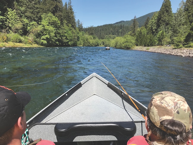
 2019 FILE PHOTO – Fishing is foundational to the economy of the McKenzie River Valley. The pandemic presented its challenges that we are now past. Because of the fire, for decades things will look and feel different on the river. But thriving guide businesses and others coming to fish are vital components of the recovery.
The summer of 2020 had been exceptionally warm in the Willamette Valley and by Labor Day the forests all across Lane County and everywhere in Oregon were exceptionally dry.
It wasn’t extraordinary, we’ve had hot, dry summers in the past, restrictions on campfires, the burning of other combustibles, power tool use and bans on anything else in the forest that could spark a fire, as usual, were in place. And we were all enjoying the fruits of our labors on the final summer holiday of the year.
But then Mother Nature blew an uncharacteristic wind at us, it was a hot, dry wind from the east. A wind that only comes once or twice a century and the historic wind blew at near hurricane force down our river canyons. … In the McKenzie River Valley at about 8 p.m. on Sept. 7, 2020 the wind became too much for the power grid, downed a power pole, causing a line to contact the ground. The line ignited a patch of dry grasses along Hwy. 126 and within 36 hours the Holiday Farm Fire, driven by the relentless wind, grew to over 170,000 acres. It burned hundreds of homes and left hundreds of our family members and friends homeless.
In addition to the lives and property the fire directly affected, it also burned through what has historically been the heart of the McKenzie River Valley’s recreational corridor.
I shared some exclusive video and photos of the aftermath of the Holiday Farm Fire on The Chronicle website back then and they were indeed horrific.
So almost two years later, how is the McKenzie River doing? In preparation of the upcoming fishing and rafting season I took a drive up the river and found much that was hard to view and other developments that gave me hope for the river’s future.
Recovery efforts continue
Of course the recovery effort is still ongoing, residents are still struggling in the aftermath of the devastation and the valley will likely take several lifetimes to return to something we all might recall. Between river mile 24 up to river mile 48, the river corridor is very different and even though I have driven upriver thousands of times in my four-decade river guide career, a couple of times I have found myself momentarily lost on the highway because of the absence of the landmarks. Landmarks I would mentally click off as I traveled upriver to meet my clients for the day. The fire also burned down the south side of the river west of RM.24, fortunately spared the Leaburg Hatchery and that damage is not so obvious from the highway.
From Rainbow where the fire started, down river to Leaburg Dam, the river bank has been mostly stripped of its foliage and a lot of trees have been removed that were deemed to be hazardous.
With so much burned or cleared away, as you drive along, portions of the river that were hidden by the tree canopy and brush are now clearly visible from the road. Rapids like Cooks, Clover Point, Eagle Rock, Rennie and Browns Hole are all now easy to identify as you pass. Debris in the river will likely be a problem for a few years, there are burned over islands and those trees will eventually fall. But the upside is, you can see the critical spots from the road.
The day I was upriver I spotted several snags that were out of the boating channel and at press time, according to the Oregon State Marine Board, there were no river hazards in the recovery section.
There is very good news and I’m glad to report, in the next couple of weeks all the boat landings in the recovery zone form RM.26, the location of the EWEB landing, upriver to Forest Glen Park (in Blue River) at RM.41 will be open to the public, including the popular Ben & Kay Doris Park and Landing, a state park located at the head of Martin Rapids.
On the day I visited, the park road was nearly cleared. Be prepared, there are no trees in Ben & Kay, it’s pretty stark but the availability of the landing is a key addition to returning the valuable river traffic to the McKenzie Valley. Other boat landings in the recovery are in good shape, Finn Rock, a holding of the McKenzie River Trust, is operational and has a restroom. Silver Creek, a BLM landing, did lose the picnic deck but the restroom there was also open. Prince Helfrich Park below Martin Rapids has been usable since shortly after the fire and had been the only landing since the fire below Silver Creek. Finally, EWEB Landing at the head of Leaburg lake, everything there is ready to go too. As you might imagine, there is little park infrastructure remaining anywhere, restrooms are at a premium in the recovery zone.
I could not find a single park bench and all the little lodges, cabins and B&Bs that lined the bank are gone too.
McKenzie is unique
On just about any other river, losing 26 miles of tree canopy would only add to the level of the catastrophe created by the burn. But because of the McKenzie’s unique hydrogeology, a result of the McKenzie valley’s volcanic past, the river runs cold and clear all year-round. Even on days that the thermometer reads in the triple digits the trout remain active in the cold river water. Other biological issues could develop, with so much exposed ground, siltation could become a problem, filling in spawning gravels, but time will tell. Trees in the river represent a hazard only to boaters but woody debris provides fish habitats and last fall spawning chinook salmon were plentiful. My personal assessment is that the river remains healthy below the water’s surface, that the fire was not all bad and that fishing on the McKenzie River this season and in future seasons should be good.
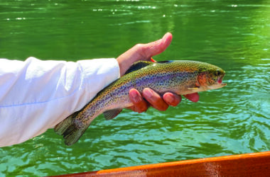
Speaking of fishing on the McKenzie River above Leaburg Dam, trout stocking begins the week of April 25 when 6,166 keeper rainbow trout raised at Leaburg Hatchery by the ODFW will be spread into the McKenzie by members of the McKenzie River Guides Association. On the week of May 9, another 1,000 trophy class trout will join the party and then again, week of May 16, another 7,500 keepers will be released. Early season, all the trout are stocked from Finn Rock down to EWEB landing. In June the stocking will extend up to Forest Glen Park in Blue River. The delay protects wild trout in that section, a run of the river they find to their liking during the trout spawning season.
A little about boating and fishing: the one thing that hasn’t changed is the fact that the middle McKenzie River is a solid class 2+ experienced with a very formidable class 3, Martin Rapids” that comes up at RM.29. You can almost now see Martin from Hwy 126 but “Martin Rapids is best viewed and scouted from the Goodpasture Road side of the river. A note to boaters, the landmarks you may remember are all gone. Although the bank is still generally intact it looks way different and becoming disoriented can be a problem on your first couple of floats. Oar boating is a coordination of hand and eye, the essence of muscle memory. So remembering to go left at the little cabin to avoid the rock and how to do it becomes a useless recollection. If this season is the first time you have driftboated or been rafting since the Holiday Farm Fire? Go slow, be on your toes, keep your eye out for fallen trees and wear your lifejacket. It will feel a little like learning a new river.
If you bank fish? This season and likely here again for decades. You are going to find more access to the McKenzie’s river banks than anyone has ever experienced. Look for the State Land, the river corridor has plenty. And please be aware of private property and no trespassing signs, people are struggling to rebuild their lives. In many cases a sign is the only thing that delineates their property line.
The McKenzie is not like it was but I’m happy to see that the entire length of the McKenzie River will very soon be ready for the 2022 trout fishing season and that is what rebirth looks like.
Email:
Radio: KDUN (1030 AM)


