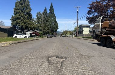
Right now, Creswell’s population sits around 5,360 people. By 2040, that number is expected to spike by 45 percent. With that anticipated increase, transportation conditions around town need to be improved to sustain such growth.
There are also areas in town that are already a bit hairy to travel. Improvements to those areas are being eyed for improvement through the in-progress Transportation System Plan (TSP).
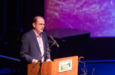
City Planner Maddie Phillips and Matt Dolata of DKS Consulting Group updated council on the TSP at last week’s joint City Council and Planning Commission meeting.
The TSP looks at all transportation modes and develops projects with a year 2040 timeline. Specific needs for types of transportation were identified including pedestrian, bicycle, transit, airport and safety.
There were a total of 78 projects identified – 30 high priority projects with a projected cost of $42.3 million; 25 medium priority projects with a projected cost of $23.3 million; and 23 low priority projects with a projected cost of $54.9 million.
The full project list is estimated at a cost of $129 million; however, the City expects they will have $8.5 million available for improvements spanning from 2020 to 2040, Phillips said.
Creswell’s TSP is funded mostly through Oregon Department of Transportation (ODOT), with a contribution of $50,000 from the City of Creswell.
The project team has been working on developing a draft since May 2017. Public input has shaped the project through comments received, a virtual open house event, direct conversations with the Project Managing Team (PMT) members and a series of meetings with the Project Advisory Committee (PAC).
TRAFFIC CONCERNS, ACCIDENT
According to the summary of traffic engineering work, Creswell should focus on Interstate 5 intersections, Oregon Avenue and Front Street, and Melton Road and Emerald Parkway intersections. The OR 99 / OR 222 crossing, or ”the jog,” also needs to be coordinated.
According to the most recent ODOT crash data, between 2011 and 2015 there were 150 crashes with the urban growth boundary, averaging 30 a year with zero fatalities.
Thirty-six occured on Interstate 5 or the ramps at the OR 222 interchange. The remaining 114 crashes occurred off the freeway system, with the majority occurring on Oregon Avenue, Cloverdale Road and the OR 222 corridor.
Crash types vary, but the majority involved rear-end collisions (50), turning movements (37) and drivers leaving the road and hitting a fixed object (24), such as a mailbox.
There were three collisions involving pedestrians over the five-year span, all of which resulted in moderate to minor injuries and occurred during the day. Two of the crashes occured at the intersections on D Avenue with Front and 4th streets, with the third on Kings Row between South 7th Street and Holbrook Lane.
In five years, three collisions occurred involving bicyclists – two at Mill and Front streets and one on North 6 Street and Hillegas Avenue.
The following needs were identified in the existing conditions analysis along with the needs anticipated for 2040 future conditions:
TRANSPORTATION SYSTEM
Transportation system identified improvements include:
▲ Additional east to west street connectivity for crossing Interstate 5, OR 99 and the railroad that improves access for first responders;
▲ Improve local street connectivity to support direct connections for existing and future development;
▲ Address the congestion and queuing of cars at the OR 99 / OR 222 crossing, or ”the jog” between Front and Mill streets at the railroad crossing;
▲ Address the future mobility decificeneis at the intersections at the Interstate 5 ramp terminals – the northbound and southbound ramp intersections;
▲ Address the future mobility deficiency at the Cloverdale Road and Emerald Parkway intersection;
▲ Address traffic congestion at the Melton Road and Emerald Parkway intersection;
▲ Address access spacing on segments of OR 99 and OR 222 that do not meet current standards;
▲ Monitor overall crashes at Dale Kuni Road and Emerald Parkway, at Dale Kuni Road and West Cloverdale Road and West Oregon Avenue and First Street intersections;
▲ Monitor rear-end crashes near the Front and Mill streets intersections and;
▲ Monitor turn-related crashes at the intersection of OR 222 and the Interstate 5 southbound ramp terminal.
PEDESTRIAN
The highest pedestrian volumes were founds along the intersections of West Oregon Avenue and 1st Street; Oregon Avenue and Front Street; and Harvey Road and West A Street. The pedestrian volumes at these intersections ranged from 94 to 173 people between 2 and 7 p.m.
The walking population needs identified are as follows:
▲ Additional east to west street connectivity across Interstate 5, OR 99 and the railroad;
▲ Sidewalks on missing segments along arterials – which carry higher volumes of traffic and are often more than two lanes – including Emerald Parkway to the east of the urban growth boundary, South Front Street and North Mill Street;
▲ Sidewalks on missing segments along major and minor collectors;
▲ Improved crossing opportunities and pedestrian facilities – such as Americans with Disabilities Act (ADA) compliant ramps – connecting to and through the downtown commercial zone beyond Oregon Avenue;
▲ Marked crosswalks near transit stops and sidewalks on missing segments near the transit stops;
▲ Improved crossing opportunities and completed missing sidewalk segments on North 5th Street and North Harvey Road to enhance neighborhood access and safe routes to schools and the Cobalt Activity Center;
▲ Improved pedestrian access to Garden Lake Park and the Hobby Field Airport by completing and enhancing sidewalks along Melton Road and/or providing a separated pedestrian facility connection;
▲ Improved pedestrian access to industrial and commercial land along North Mill Street and South Mill Street.
▲ Marked crosswalks at the intersections of Melton Road and Dale Kuni Road along Emerald Parkway;
▲ Completed sidewalks in residential areas with messing segments;
▲ Well-maintained sidewalks and improved pedestrian facilities as needed to meet the ADA requirements;
▲ Shared use paths for walking and bicycling and;
▲ A designed low-stress pedestrian network that provides safe connections to schools, parks and other areas of high interest.
BICYCLE
Bicycle volumes, compared to the pedestrian volumes in the commercial downtown zones, schools and Holt Park were relatively lower, with the highest counts ranging from 10 to 14 bicycles between 2 and 7 p.m.
The highest volumes were found along West Oregon avenue and 1st Street; Oregon Avenue and Front Street; Oregon Avenue and Mill Street; Cloverdale Road and Mill Street; and Harvey Road and Niblock Lane.
The cycling population needs identified are as follows:
▲ Additional east to west street connectivity for crossing Interstate 5, OR 99 and the railroad;
▲ Appropriate bicycle facilities for travel adjacent to higher-speed vehicle on the segments of OR 99 and OR 222;
▲ Appropriate bicycle facilities for travel adjacent to higher-speed vehicle traffic of North Harvey Road and South 10th Street near schools and the Cobalt Activity Center;
▲ Consistent bicycle facilities on OR 99 and the Oregon Avenue, Cloverdale Road and OR 222 corridor;
▲ Improved bike facilities connecting residential areas to the downtown commercial zone and transit stops;
▲ Improved bicycle facilities that connect residential areas to schools to provide safer routes to school;
▲ Improved crossing opportunities for bikes at the intersection of Front Street and Oregon Avenue and;
▲ Improved bike access to Garden Lake Park and the Hobby Field Airport on Melton Road and/or new bike connections.
TRANSIT
According to Lane Transit District (LTD), ridership in Creswell includes an estimated 4,722 annual rides on and off the South 2nd and F Street stop; 15,360 annual rides on and off the South 1st and C Street stop; 8,849 annual rides on and off the stop between North Mill Street and Interstate 5 westbound ramp; and 1,852 annual rides on and off the North Mill and Interstate 5 eastbound ramp.
The transit population needs identified are as follows:
▲ Consider increasing the number of fixed route bus stops to better serve future land uses beyond the downtown commercial zone, particularly east of Interstate 5 and residential neighborhoods toward the north end of the City;
▲ Additional bus stop amenities such as shelters, benches or bike parking and;
▲ Improve bike and pedestrian access to transit stops, particularly via low-stress routes.
Next steps for the TSP include furthering development and evaluations of various solutions, and to slate another open house and more public engagement.
A draft of the TSP will be developed in the fall for council review.
The plan is expected to be adopted in early 2019.


